
417-532-7612
Location:
Dallas County

News, Updates, & Warnings:
Open to hunters during hunting seasons.
There is a gun range in the south east area of the trail system.
This is in an Amish community so use caution when driving as there are horses and buggies on the roads at times.
Directions:
Campground: From Lebanon, take Hwy 64 west about 23 miles to Hwy T, turn north. Follow Hwy T for 9 miles to Hwy YY, turn east. There is a sign here. Go 0.5 of a mile to the entrance and turn left into the area. Continue straight for 0.8 of a mile and you'll see a day use trailhead in front of you. Turn right and follow road 1.7 miles further to the campground on the left.
GPS Co-ordinates:
Day Use Trailhead: N37.84062, W-92.95192
Campground: N37.85034, W-92.93007
Trailer Parking:
Ample
Season:
Year-round.
Fees:
No day use or camping fees.
Miles of Trails:
23 miles in multiple loops.
Equestrian Camping:
Yes, there is a nice designated campground with room for about 25 horse trailers. It's just before the big hill that goes down to the river.
Cart/Wagon Driving:
Allowed here other than where the Natural Areas are. There is ___ miles of gravel road and you will share it with the Amish in the area. Every time we've visited here we've seen some come into the area to enjoy it themselves.
Trail Notes:
The trails are listed both as colors and as symbols, however all of the trails are blazed with yellow plastic squares that have the symbols on it, so the trails are not color coded. Most of the trail is two track that is wide enough to ride two horses abreast. It is easy to follow, with a few creeks to cross and some deadfall to negotiate. The blue and red trails are both a bit easier, while the green, orange, and yellow trails are a bit more rugged with more hills to climb. We've been here in Spring, Summer, and Fall, all are pretty, but Fall is my favorite as there is a lot of color here.
Blue Trail: 8.6 miles. Starting east of the campground, it starts out running south and is a wide gravel road until it gets down to the creek. The blue trail runs within hearing distance of a gun range so make sure your horse is used to the sound of gunfire.
Red Trail: 2.5 miles
Green Trail: 2.20 miles
Orange Trail: 5.70 miles
Yellow Trail: 3.20 miles. This trail starts from the campground, goes north, then turns east and circles back to the gravel road that goes down the middle of the trail system. About 6.6 of this trail is also a gravel road.
Gravel Road: About 5.5 miles. The main gravel road that runs down the middle of the trail system is about 3.5 miles long and gets VERY steep at the end when it goes down to the Niangua River. At the last road on the left, there is a warning sign about how steep it is and you can use the gravel road/yellow trail to turn around so you don't have to go down it. If you have a trailer, it would be very hard to get back up it.
Maps:
Color map
GPX file
Other Trail Users:
Hikers, area Amish, and hunters.
Other Activities:
Hiking, camping, hunting, fishing, orienteering, wildlife study and photography.
Facilities:
Outhouse, highline posts and metal fire-rings at the campsites, 3 hitching rails, and a mounting block by the outhouse.
Drinking Water: None Available.
Water for horses: Cistern water at the campground as well as creeks along the trail.
Other Services:
Car Care, Groceries, & Restaurants: Lebanon, about 30 miles east.
Tack and Feed: George's Tack, Saddle, & Feed
Camdenton
573-346-7866
Emergency Information:
Cell Phone Signal: Moderate
Dallas County Sheriff: 417-345-2441
Hospital: St. Johns's Hospital - Lebanon
GPS: N37.68121, W-92.63571
Lebanon
417-533-6100
Veterinarian: Howerton Animal Hospital
Lebanon
Volunteers Helping With This Page:
No one at this time, available to adopt. If interested, please contact us.
Photos:
Campground photos:
 |
| Parking Pads for horse trailers. |
 |
| Highline Poles. Each Equine Campsite has one set of these. |
 |
| Metal Fire Ring |
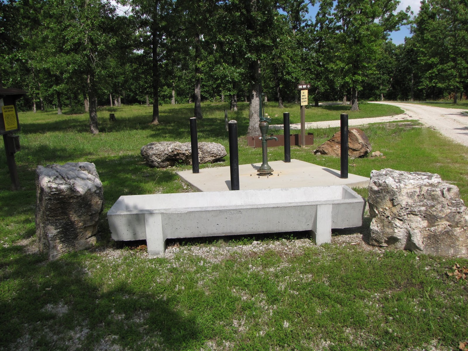 |
| Cistern for water and water trough. |
 |
| Outhouse |
 |
| Outhouse and all 3 hitching rails. Hitching rails installed by SMMBCH. |
 |
| Mounting block installed by SMMBCH. |
Trail Photos:
 |
| Typical trail. |
 |
| Even though MDC's trail map color codes the different trails, this is how the trails are marked. All blazes are yellow with different symbols on them. |
 |
| Some are two track trails. |
 |
| More Wide Trail |
 |
| There are a few interesting trees if you keep your eyes open. |
 |
| This is part of the horse shoe trail. |
 |
| Most trails are shady and wide. |
 |
| Some of the trail tread can be rocky. |
 |
| Starting to loose their leaves. |
 |
| Fall in the lower fields. |
 |
| One of the more rugged parts of the trail. |
 |
| Part of the "Blue Trail" that starts off as road. |
 |
| Trail next to the river. |
 |
| The Niagua River |